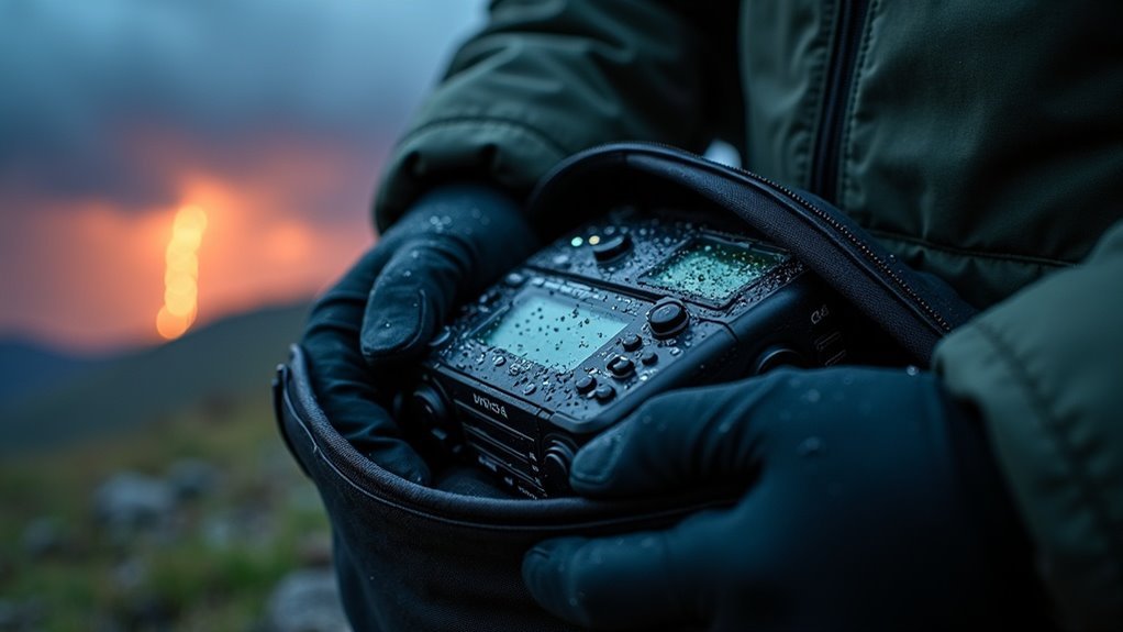
To read river gauge forecasts effectively for survival and prepping, focus on critical metrics such as cubic feet per second (CFS) and gauge height. CFS measures water flow, which is essential for assessing potential hazards during navigation, especially in emergency situations. For the Brazos River, a flow rate between 500 to 3000 CFS is considered optimal for safe passage. Gauge height, which indicates water depth, is crucial for evaluating risks and making informed decisions about crossing or utilizing the water source.
Utilize color-coded charts for quick assessments—green typically represents safe conditions, while yellow and red may indicate rising risks. Additionally, stay connected with local resources for real-time updates and valuable insights, ensuring your preparedness remains strong. Understanding these metrics can significantly enhance your survival strategies when dealing with waterways.
Key Takeaways
- Understand the gauge height measurements, as they indicate water depth and navigability of the river, which is crucial for survival situations.
- Review the last column of river gauge charts for current discharge rates in cubic feet per second (CFS), as this information can help you plan safe water crossings or fishing opportunities.
- Use color coding on charts to quickly assess conditions: green typically indicates ideal flow rates for navigation, aiding in efficient travel or resource gathering.
- Compare current flow rates with historical data to evaluate trends and anticipate safe paddling conditions, which is essential for effective emergency planning.
- Engage with local paddlers and resources for additional insights on specific river characteristics and hazards not reflected in gauges, enhancing your preparedness for unexpected scenarios.
Understanding River Flow Measurements
When you gauge river flow measurements for survival and prepping purposes, it’s crucial to understand that river flow is typically quantified in cubic feet per second (CFS), indicating the volume of water moving through a specific point in the river.
Flow rates can significantly impact your ability to navigate waterways safely; for example, a flow rate of 200 CFS usually allows for floating in certain rivers.
Flow rates greatly influence safe navigation, with 200 CFS typically permitting floating in select rivers.
For the Brazos River, the ideal flow for safe navigation ranges between 500 CFS and 3000 CFS, depending on various conditions.
While river gauges offer current data, they don’t provide predictions for future water levels.
Gauge Feet vs. Cubic Feet per Second (CFS)
Understanding the difference between Gauge Feet and Cubic Feet per Second (CFS) is essential for survivalists and preppers navigating rivers. Gauge Feet measures water height, which is critical for identifying potential obstacles and hazards in the waterway. On the other hand, CFS quantifies the volume of water flow, providing insights into river dynamics that can affect your safety and preparedness. Here’s a comparison:
| Measurement | Description |
|---|---|
| Gauge Feet | Indicates water height on a ruler, essential for assessing depth and safety |
| Cubic Feet/Second | Measures the volume of water flowing past a point, crucial for understanding river strength and current |
| Example | 9,000 CFS = 9,000 basketballs crossing per second, illustrating the flow’s intensity |
| Importance | Correlates height with flow, vital for safe navigation and survival strategies in varying river conditions |
Understanding both metrics ensures you’re equipped to deal with diverse river environments, enhancing your preparedness for outdoor adventures or emergency situations.
How to Interpret River Gauge Charts
River gauge charts are essential tools for survivalists and preppers, providing crucial insights into real-time river conditions that can impact outdoor activities and emergency planning.
These charts display flow rates in cubic feet per second (CFS) alongside historical data, enabling you to assess current conditions and trends that may affect your safety and preparedness. The last column indicates discharge in CFS, which is vital for evaluating the suitability of the river for various activities, such as crossing or sourcing water.
Gauge height is also represented, assisting in determining navigability and potential hazards. By analyzing flow rate trends and understanding the color coding—where green signifies ideal conditions—you can swiftly assess whether the river’s current levels align with safe practices for survival and recreation.
Optimal Flow Levels for Popular Rivers
Understanding optimal flow levels in rivers is crucial for survivalists and preppers who may encounter these waterways during an emergency situation or wilderness expedition.
For the Brazos River, safe flow levels range between 500 cfs and 3000 cfs, ensuring that you can navigate effectively while minimizing risks.
Safe flow levels for the Brazos River lie between 500 cfs and 3000 cfs, promoting effective navigation and reduced risks.
The Yampa River is best tackled at around 2,500 cfs, providing a good balance of challenge and accessibility for those prepared for the environment.
On the Upper Colorado River, ideal conditions occur at flows from 1,000 cfs to 4,000 cfs, which can vary depending on the river stretch.
It’s essential to remember that local guidebooks and resources emphasize that ideal flow levels depend on the river’s character and gradient.
Personal experience and local knowledge are vital for safe navigation in survival scenarios.
Always consult local recommendations and prepare accordingly before attempting any paddling or river navigation.
Navigability Considerations Based on Flow Rates
Understanding ideal flow levels is essential for assessing navigability on rivers, especially in survival situations where preparation is key.
Different conditions can significantly impact your ability to traverse waterways safely. Your personal experience, local knowledge, and survival skills play crucial roles in evaluating whether a river is suitable for paddling at a given flow rate.
Utilizing guidebooks and trip reports can further enhance your decision-making by providing specific insights on boatable levels, which is vital for any prepper looking to navigate natural resources effectively.
Optimal Flow Levels
When planning your survivalist paddling trip, understanding the ideal flow levels is crucial for ensuring safety and navigability in potential emergency situations.
For the Brazos River, optimal flow levels range between 500 cfs and 3000 cfs, while 200 cfs is often sufficient for floating in rivers with lower gradients, which could be vital for escape routes or resource gathering.
It’s essential to consult survival guidebooks and trip reports that detail boatable levels specific to your river, as these resources can aid in your preparedness.
Additionally, observing river conditions at various flows will enhance your ability to assess what constitutes a safe paddling experience.
Analyzing historical flow data trends is also important; it can help you anticipate whether current conditions are suitable for navigation, ensuring you’re prepared for any situation that may arise during your trip.
Personal Experience Importance
While personal experience is crucial in assessing navigability, it’s important to remember that each river has distinct characteristics that affect how flow rates impact safety and enjoyment—critical considerations for survivalists and preppers. Understanding river levels enables you to effectively gauge conditions, which is vital for planning safe routes during outdoor excursions or emergencies.
| River Type | Minimum Flow (cfs) | Ideal Flow (cfs) | Maximum Flow (cfs) |
|---|---|---|---|
| Low Gradient Rivers | 200 | 300 | 500 |
| Gravel Bar Rivers | 400 | 600 | 800 |
| Steep Rivers | 300 | 500 | 700 |
| Wide Rivers | 250 | 400 | 600 |
Local Knowledge Benefits
Local knowledge significantly enhances your ability to assess navigability based on flow rates, which is crucial for survivalists and preppers who may need to traverse waterways in emergency situations.
Each river’s unique characteristics can dramatically affect how it handles different water levels, making local insights invaluable. For example, lower gradient rivers often accommodate lower flows better than gravel bar rivers.
Experienced paddlers generally consider 200 cfs a minimum for floating, but community knowledge is essential for verification in survival scenarios. Observing river conditions at various flows helps you build critical judgment, while guidebooks and trip reports provide essential information.
Engaging with the local paddling community or river authorities can clarify current navigability, ensuring you’re well-prepared for safe and effective trips in any situation.
Utilizing Local Resources for River Conditions
To navigate river conditions effectively for survival and prepping, utilizing local resources is crucial. Connecting with local paddlers can provide real-time updates on the river’s flow, hazards, and navigability that weather forecasts may overlook.
Visit local outdoor shops for firsthand insights on current conditions, as staff often share recent experiences and tips for safe navigation in various scenarios. Engage in online survivalist forums to gather information from fellow preppers about specific rivers and sections that may be crucial for emergency routes.
Additionally, resources like American Whitewater offer detailed flow data and community reports that can aid in planning safe excursions. Attending local paddling meetups can also help you build connections with experienced paddlers who can share invaluable knowledge for traversing waterways successfully and safely in preparing for potential emergencies.
Safety Tips for Paddling Based on Gauge Data
Before setting out on your paddling adventure, it’s crucial to check the current river gauge data to stay informed about flow conditions that can change rapidly.
Understanding the implications of specific gauge heights for your route is vital, so connect with local survivalist and prepping communities for real-time insights.
Prioritize your safety by aligning your skill level with the river’s current challenges based on the gauge readings, and always be prepared for unexpected situations.
Check Current Conditions
Checking current river conditions is crucial for ensuring a safe paddling experience, especially for survivalists and preppers who prioritize self-sufficiency.
Flow rates can fluctuate dramatically due to weather changes, which can impact your ability to navigate waterways for gathering resources or emergency evacuation.
To navigate safely, consider these key points:
- Always check river gauges before heading out; ideal flow for the Brazos River is between 500 to 3000 cfs to ensure safety for your activities.
- Monitor updates from reliable sources like the USGS or American Whitewater, as conditions can change rapidly and may affect your plans.
- Understand gauge feet measurements to evaluate navigability; local knowledge can significantly enhance your situational awareness.
Engaging with paddling and survivalist communities can further enhance your awareness of current hazards and conditions, ensuring you’re well-prepared for your trip.
Stay informed, stay safe, and always be ready for the unexpected!
Local Knowledge Importance
While river gauges provide essential data on flow rates, relying solely on this information without local knowledge can lead to misjudgments about safety and navigability—especially in survival situations.
Each river has unique characteristics that impact how flow rates translate into paddling conditions, which is vital for preppers who may need to navigate waterways in emergency scenarios. Connect with local paddlers or outfitters to gain insights on current conditions and hidden hazards that could affect your survival plans.
Understanding historical flow patterns enhances your safety; for instance, 200 cfs might be fine for one river but inadequate for another in a crisis. Engaging with local forums like Mountain Buzz allows you to access real-time updates, helping you make informed decisions based on both gauge forecasts and local knowledge, crucial for your preparedness strategy.
Engaging With the Paddling Community for Insights
Many survivalists and preppers find that engaging with the local survival community can significantly enhance their understanding of outdoor conditions and emergency preparedness.
Engaging with the local survival community greatly improves understanding of outdoor conditions and enhances emergency preparedness.
Consider these approaches:
- Join local survival and prepping groups: Sharing experiences with fellow preppers improves your knowledge of techniques, tools, and strategies, which enhances both safety and readiness.
- Participate in community training events: Building relationships with experienced survivalists provides valuable insights on navigation, foraging, and self-sufficiency skills.
- Utilize social media: Connect with prepping communities for real-time updates and discussions about current events, survival tips, and resource sharing.